Ireland - 2007
In September 2007, my husband and I traveled to Ireland for a couple weeks. My wonderful parents had rented a large house (6 bedrooms) in Killarney, and then invited me and Dennis and a bunch of other relatives to join them. Besides the four of us, there was my sister, Susan; my sister, Betty, and her husband, Rick; Aunt Pat, my mom’s sister; and Uncle George, my mom’s brother, and his wife, Ann. We all had a wonderful time.
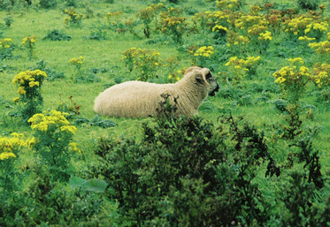
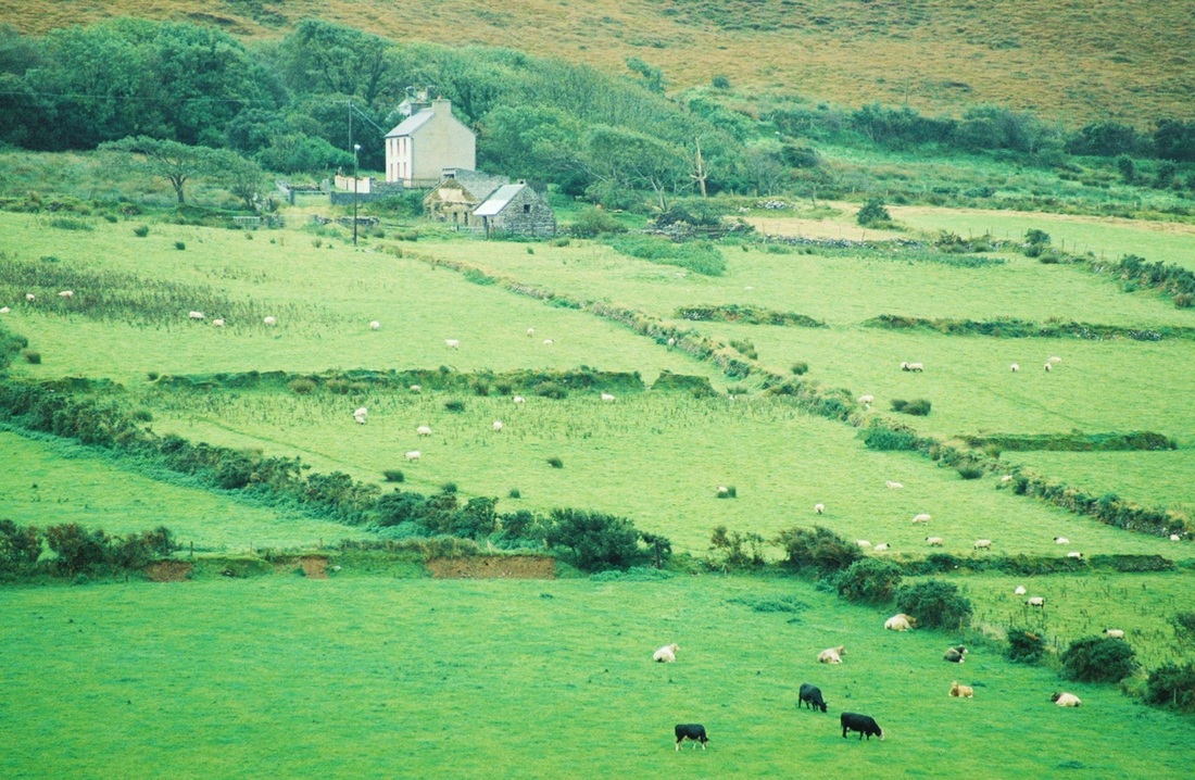
It was my first time to Ireland, and I was amazed at how “green” the color green actually was! It was a shade of green I had never seen anywhere in nature before, so bright and vibrant. So, I wondered why Ireland is so green. Apparently, the influence of the Gulf Stream and the general climate make Ireland a kind-of rain forest; therefore, it rains a lot. (While I was visiting, it rained for at least part of almost every day.) In addition, there are loads of grassy pastures and fields in Ireland, and with the mild summers and winters, the grass is always green.
(Please note that all of my photos were taken with a film camera and then scanned. I apologize in advance for the quality of them.)
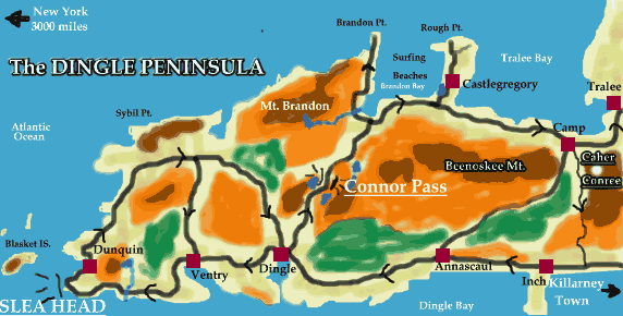
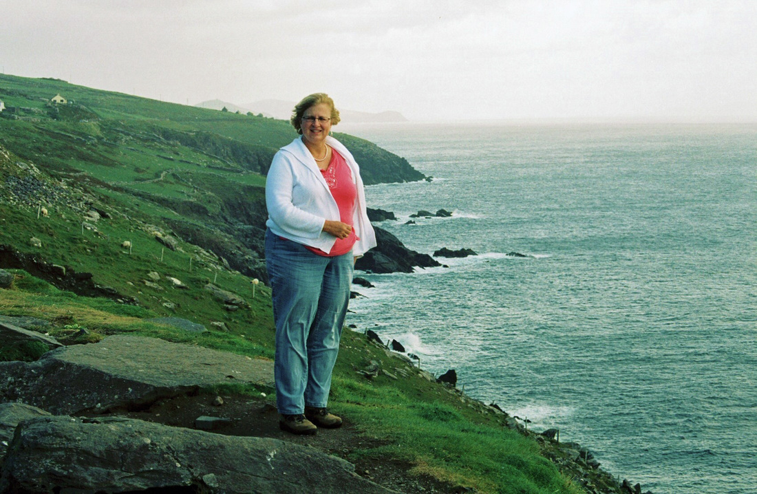
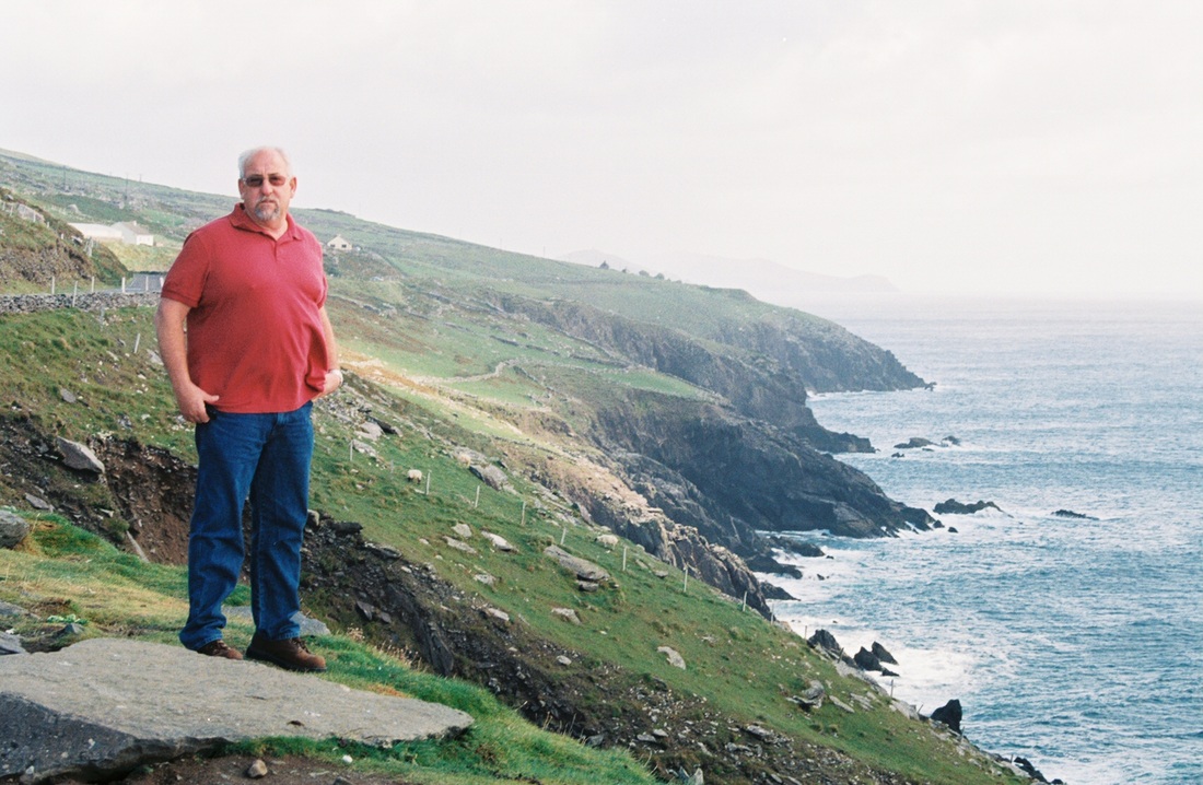
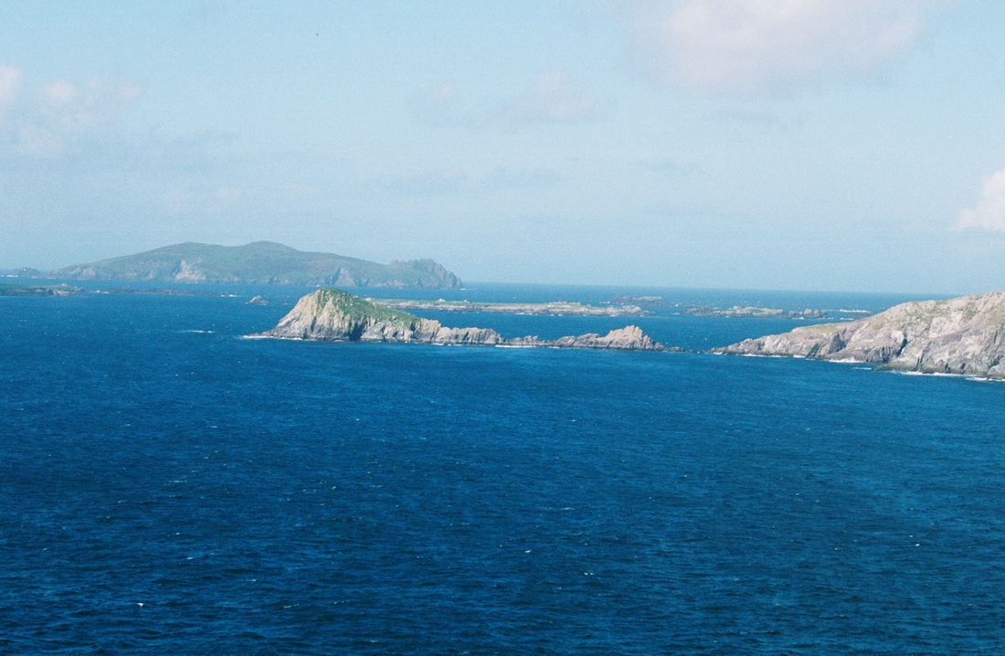
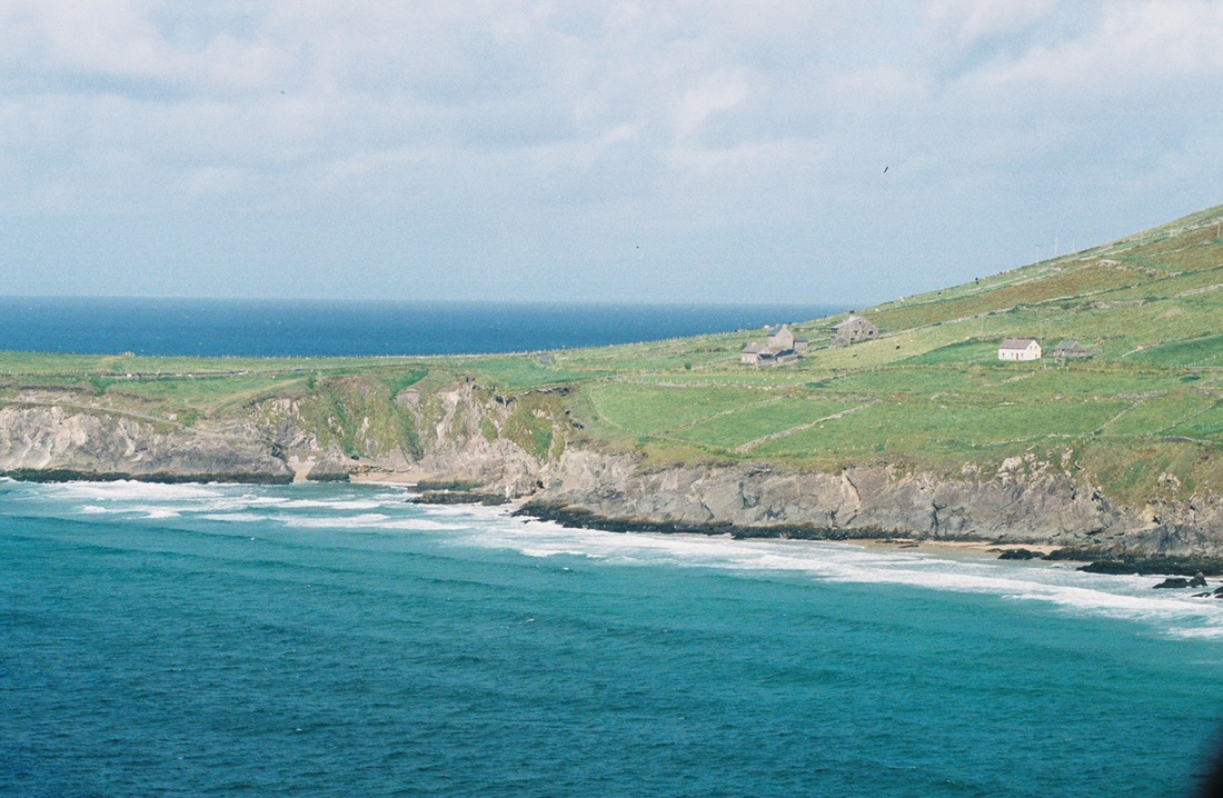
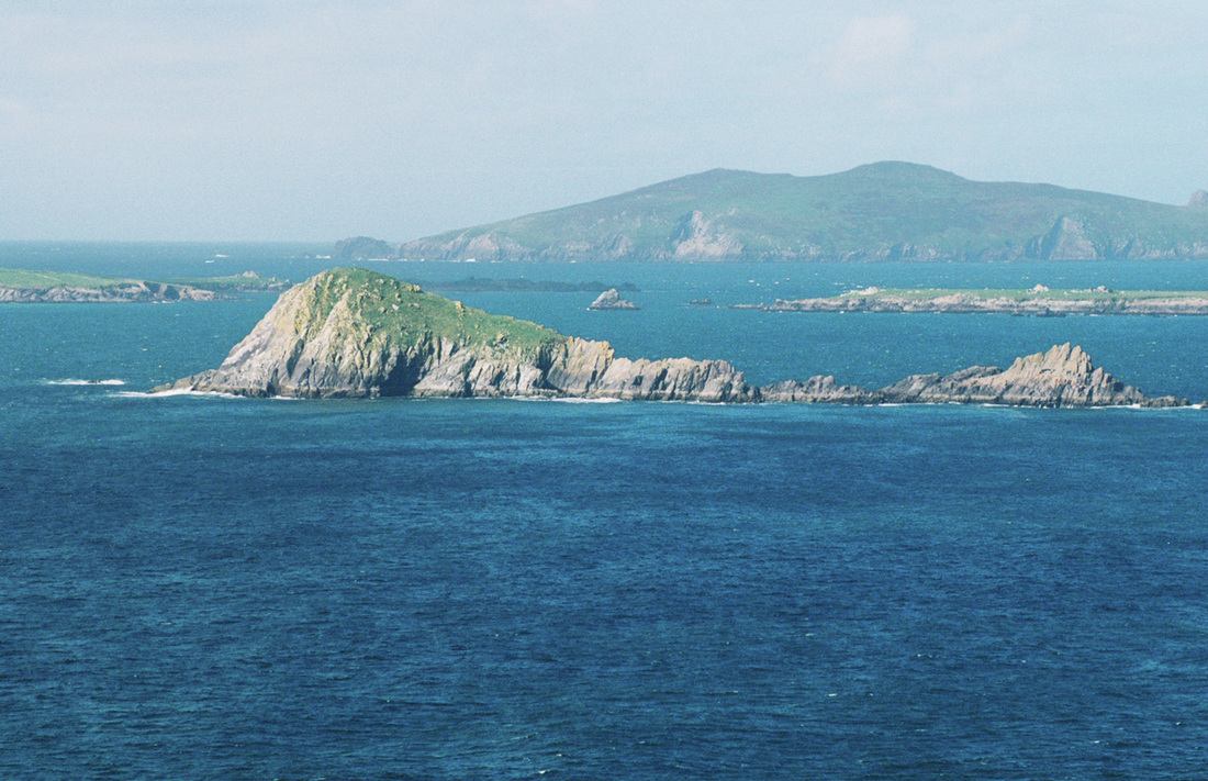
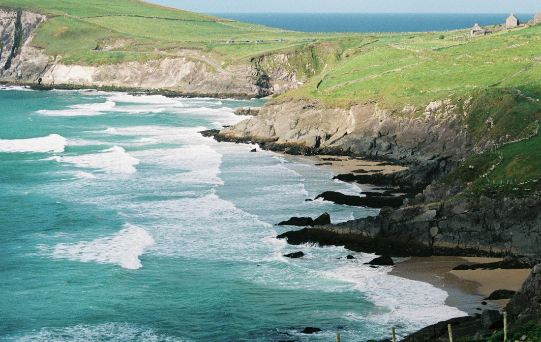
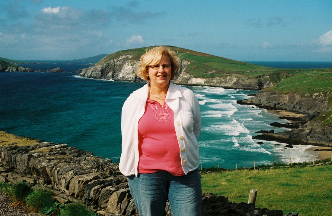
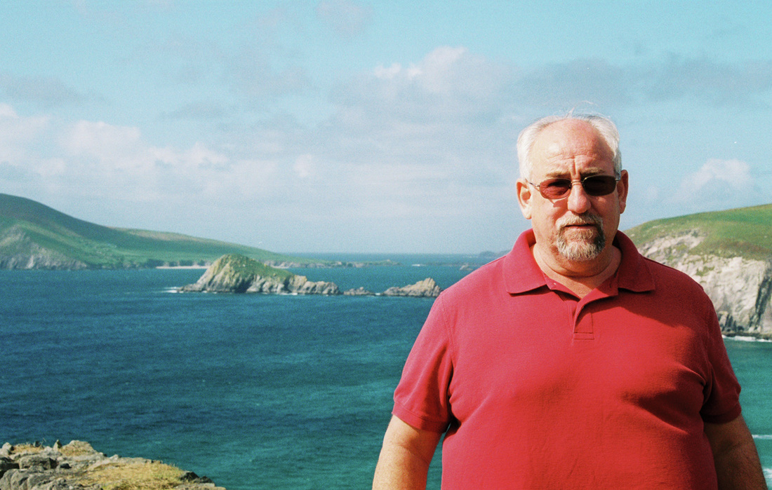
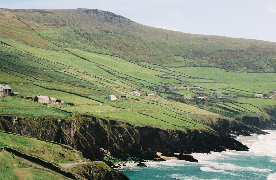
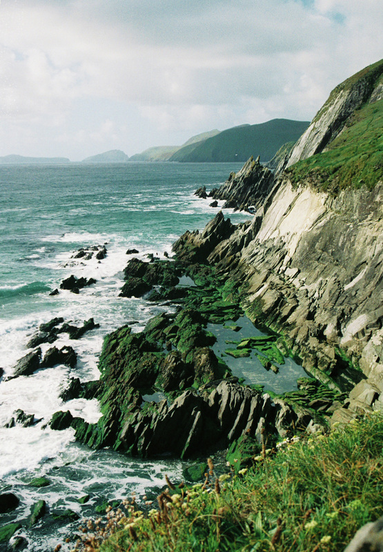
Dingle Peninsula
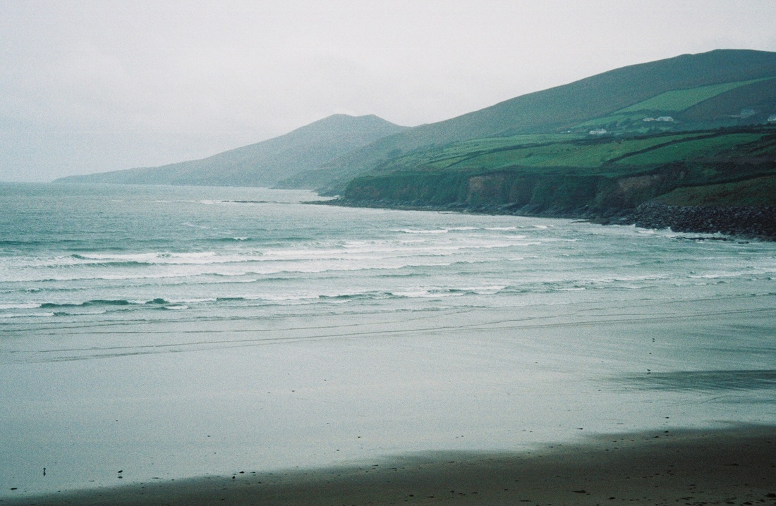
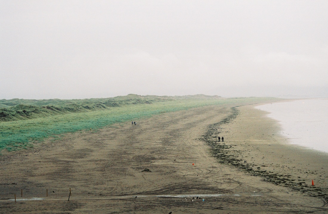
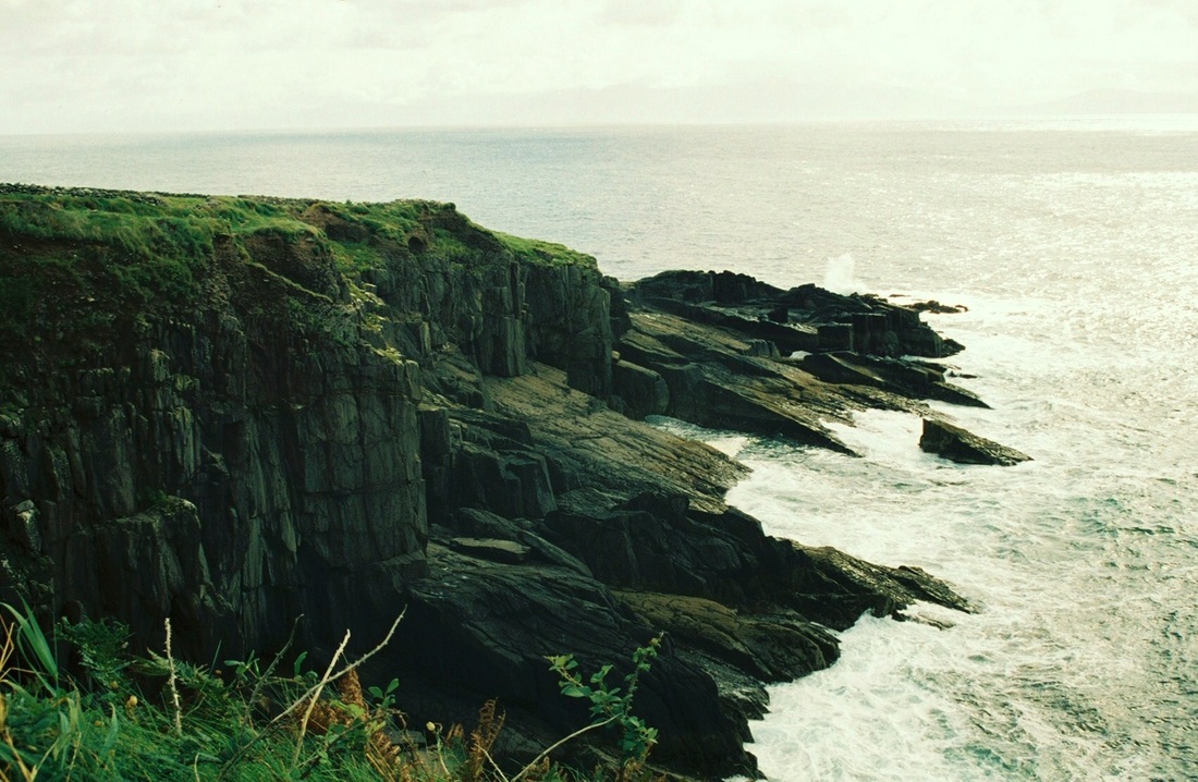
The Dingle Peninsula or Corca Dhuibhne stretches 30 miles (48 kilometres) into the Atlantic Ocean from Ireland's southwest coast. The peninsula is dominated by the range of mountains that form its spine, running from the Slieve Mish range to Mount Brandon, Ireland's second highest peak. The coastline consists of steep sea-cliffs, broken by sandy beaches, with two large sand spits at Inch in the south and the Maharees to the north. The Blasket Islands lie to the west of the peninsula.


The Hike
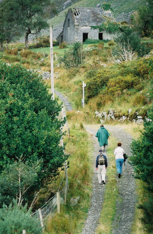
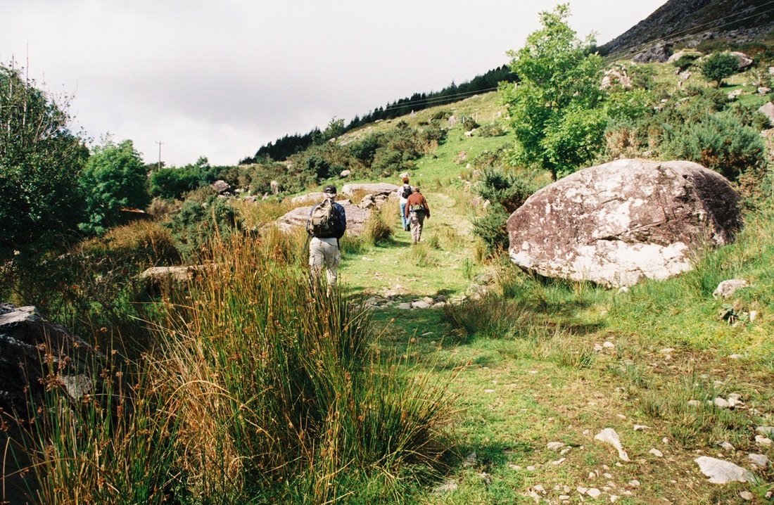
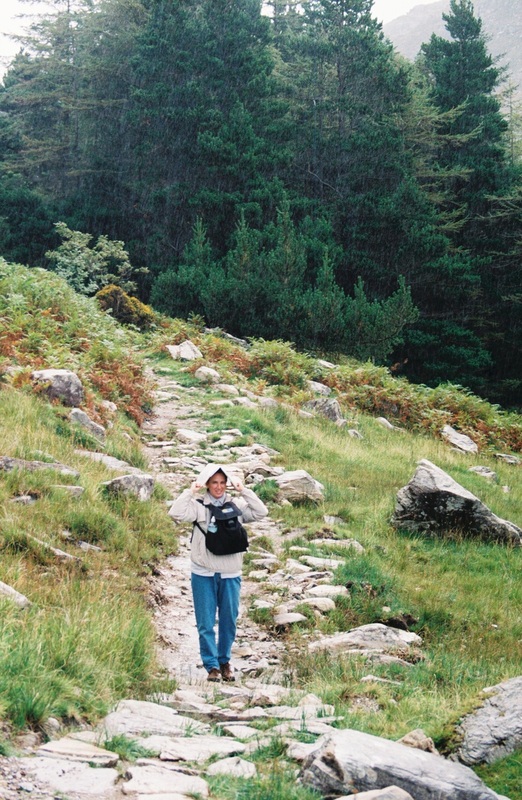
Susan, Betty, Rick and I decided to hike part of the Kerry Way, the longest – 215 kilometers – walking trail in Ireland. Of course, we were not going to hike the entire length; we were going to hike only about 10 km.
The morning of our trek, we packed a hardy lunch and dressed in warm clothes. We knew it might rain (it always does in Ireland), so we also carried our ponchos. My husband, Dennis, dropped us off in the Black Valley, the area where we were going to pick up the trail. He was going to meet us 10 km up the road in 3 hours to pick us up.
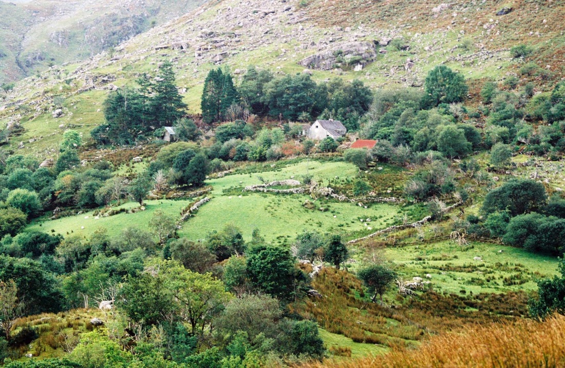
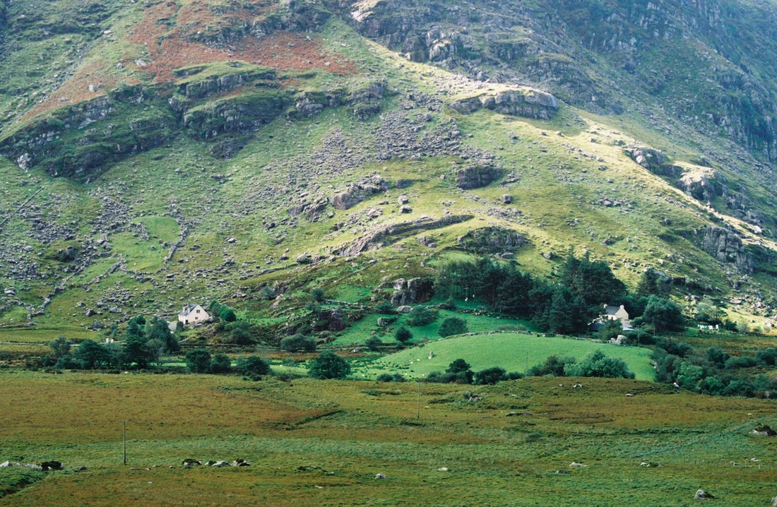
The Black Valley in County Kerry is a remote location in the Macgillycuddy’s Reeks, a chain of mountains, many over 3,000 feet, which overshadow the Valley. The Black Valley is known as one of the most beautiful and unspoilt places in the world. The Valley has a wild, rugged and extreme beauty, yet also has calmness, friendliness and tranquility. It is a natural, untamed place that reflects the peoples' struggle to make a living throughout the ages. The valley is also noted for being the last place in Ireland to get electricity and telephone service because of its remoteness. In fact, some Kerry natives will joke about the Black Valley getting its name from remaining in the dark so long without electricity. It was not until 1976 that the Valley was finally connected.
Today, the Black Valley is still a remote and untouched part of Ireland. As the name 'valley' suggests, it is more of a dispersed area than a village with a center.
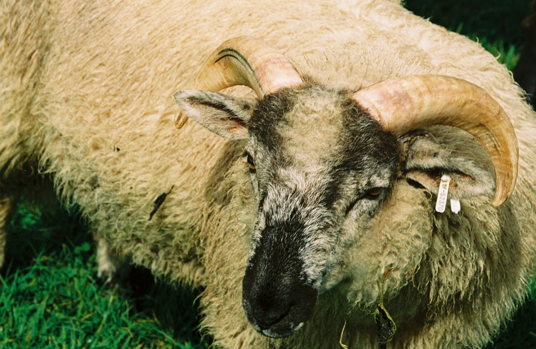
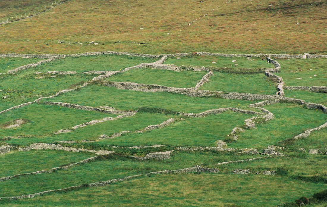
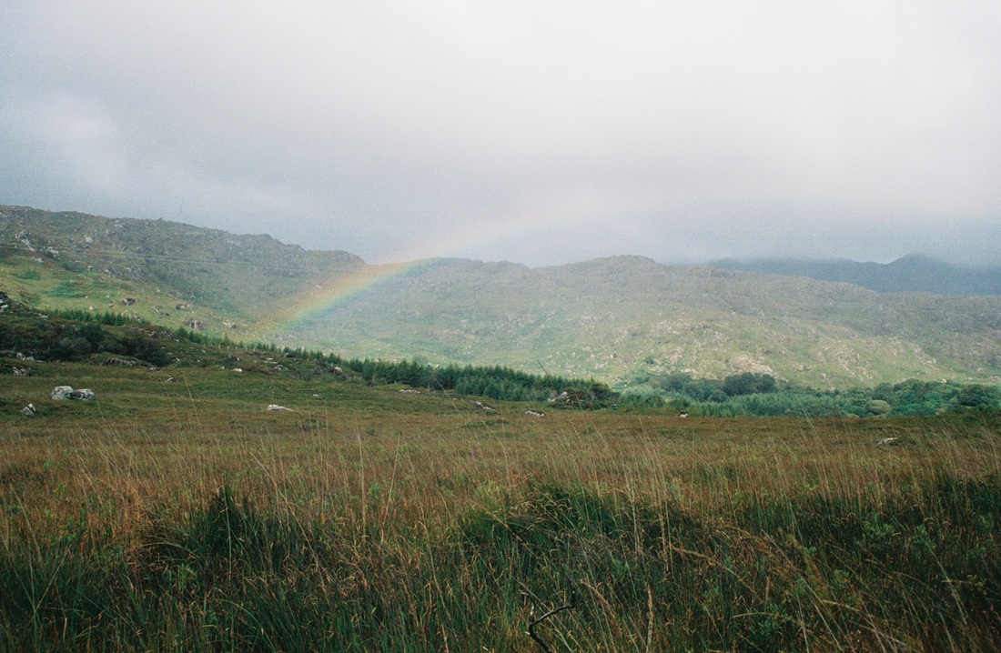
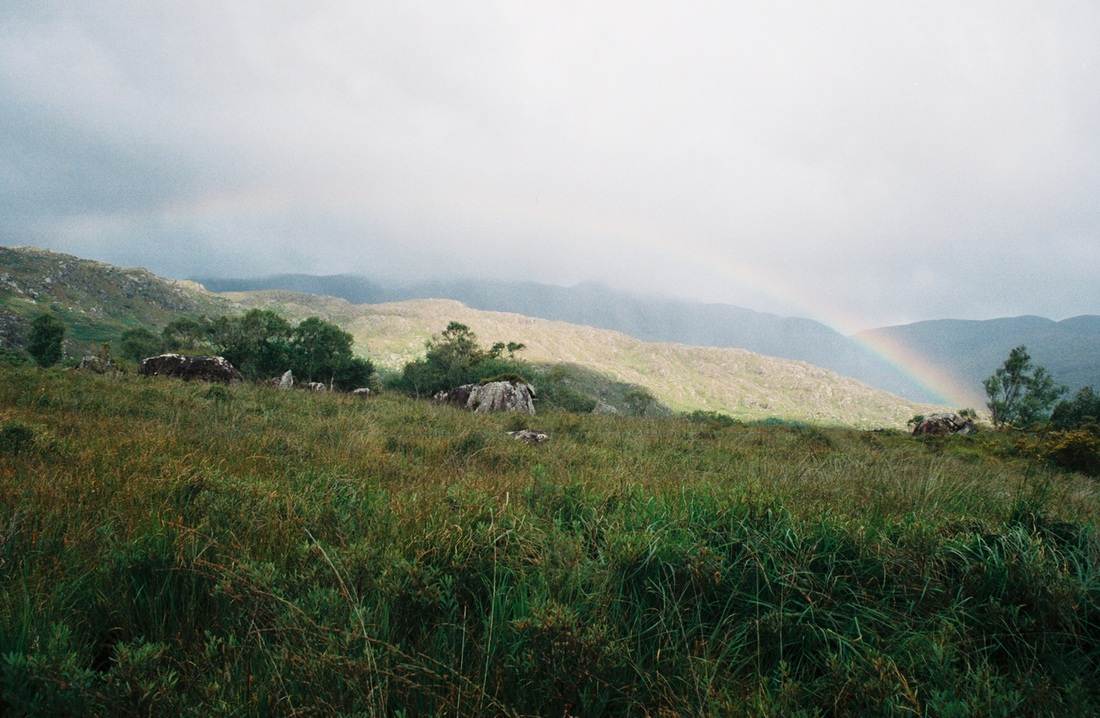
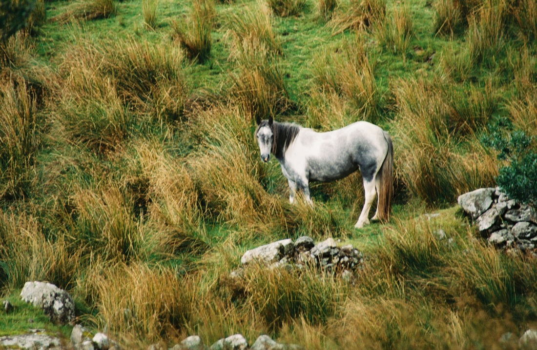
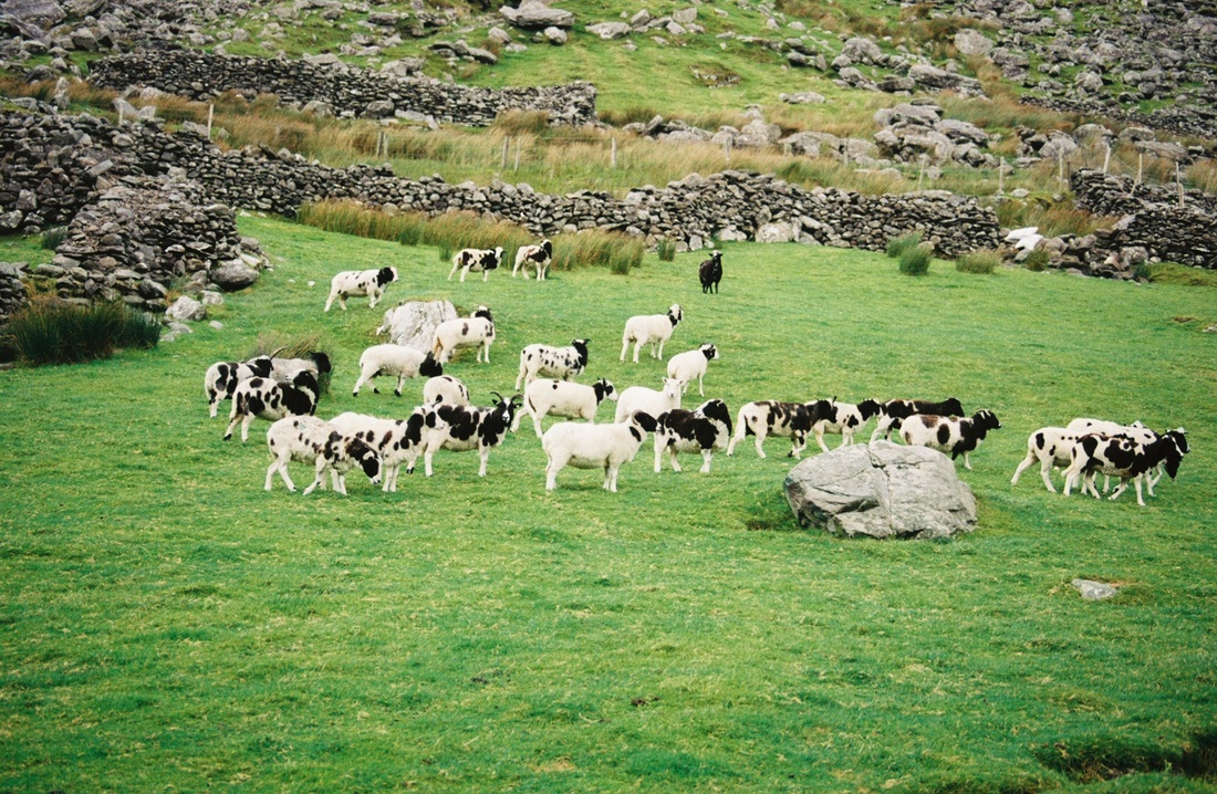
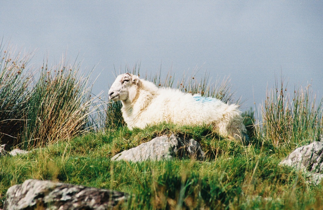
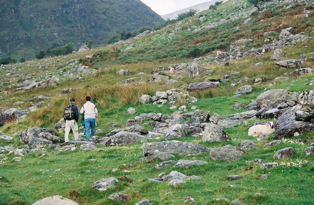
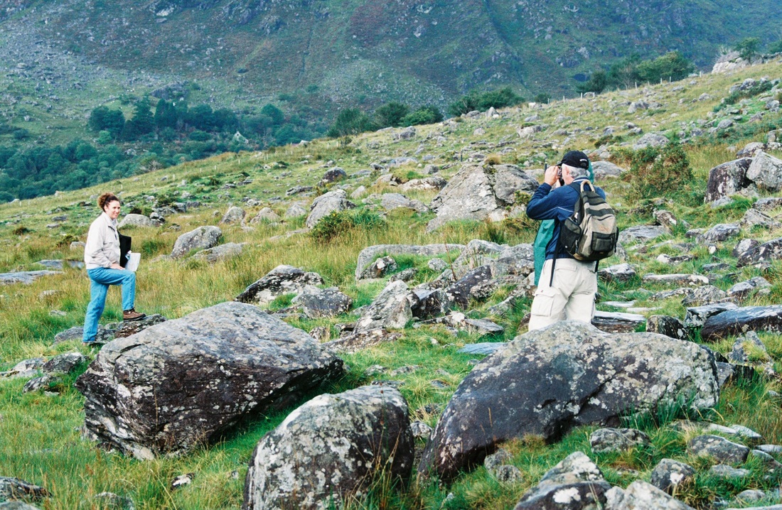
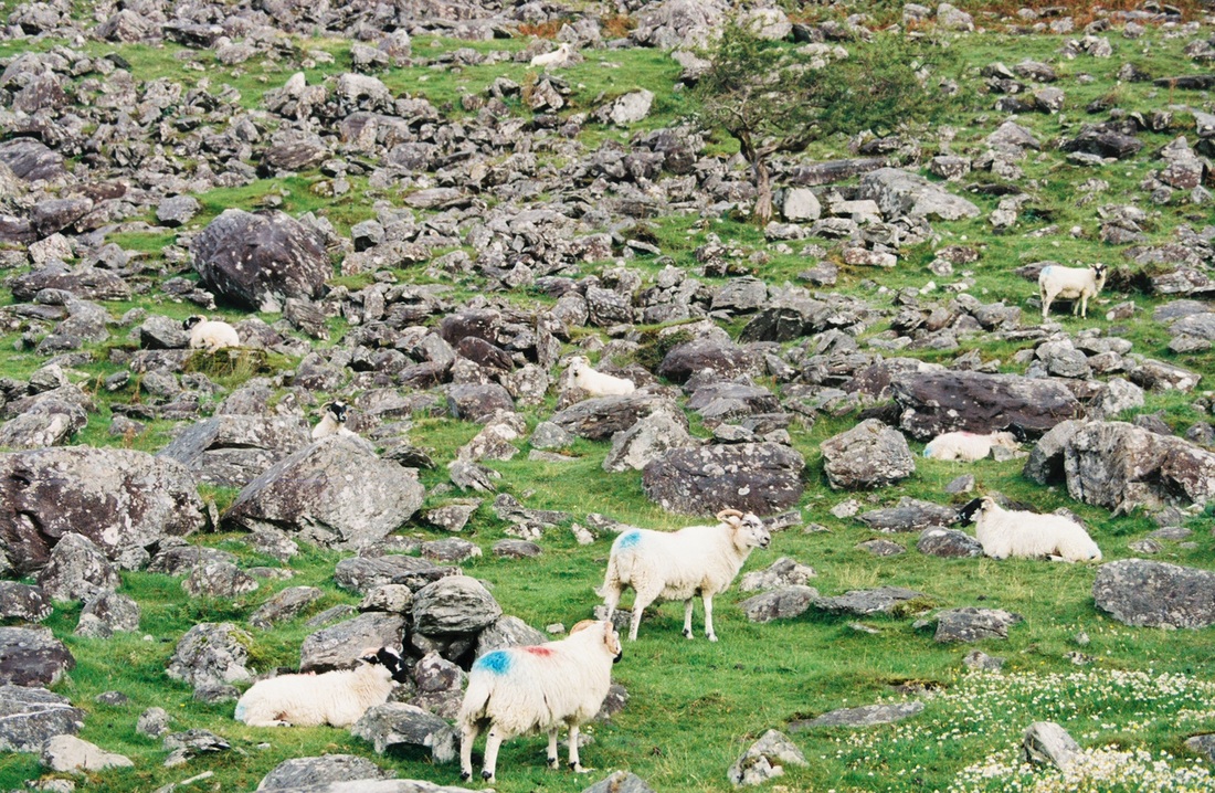
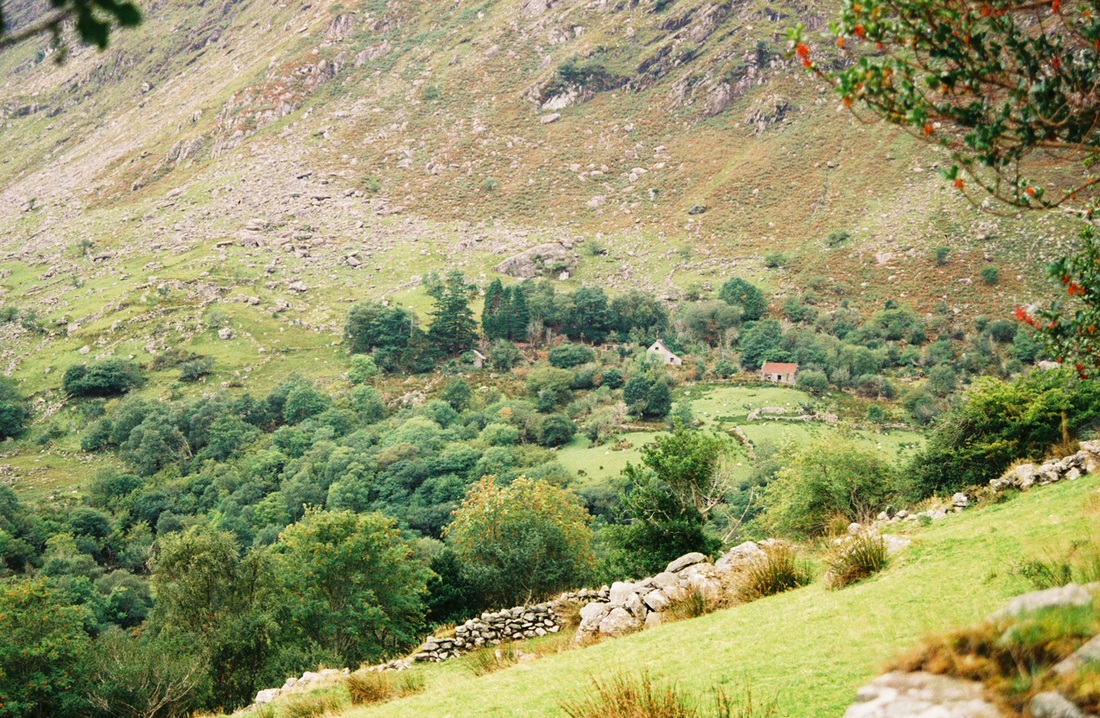
As Susan, Betty, Rick and I started “the hike,” we walked along a gravel road running next to beautiful, green pastures where black and white sheep grazed fenced in by stacked, stone walls. The road eventually turned into a wide grassy trail. Fluffy white sheep with red and blue markings foraged unrestrained along both sides of the path. Presently the trail became paved with large, flat rocks. Before long it started to drizzle, and we put on our ponchos. Soon we entered the Valley, and the trek turned difficult. Instead of a gently upward sloping path, the trail became a series of large boulders and wet, spongy ground. The sheep, which were everywhere and seemed totally oblivious of us, had no problems bouncing up and down the boulders, but I was having a time of it. It was slow going. My fellow trekkers soon were way ahead of me as I lagged behind, carefully climbing up and over boulders. Every 20 minutes or so, they stopped and waited for me to catch up.
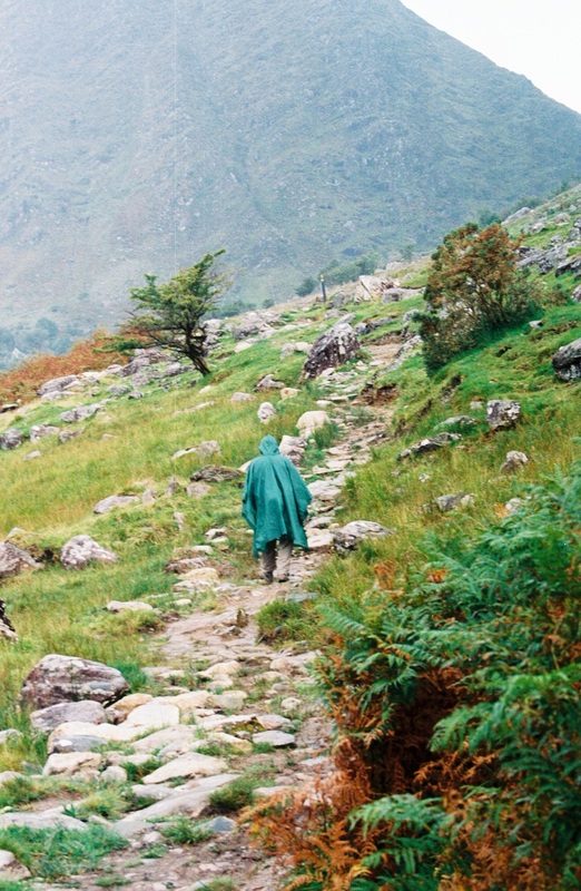
The drizzle turned into a cold rain, and the wind started blowing hard, whipping our ponchos so that our clothes were soon sodden. Mercifully, we were all wearing hiking boots with thick socks, so our feet were warm and dry. We ate our lunch during a break in the rain, and then, feeling the call of nature, I found a large rock behind which to pee. I am known for my bathroom escapades while traveling (www.thebathroomdiaries.weebly.com), so of course Betty had to sneak (unbeknownst to me) and videotape me doing my business. Thankfully, no one else was around. (In fact, we saw only two other hikers [backpackers, actually] the entire time we were on the trail, and that was at the very beginning of our hike.)
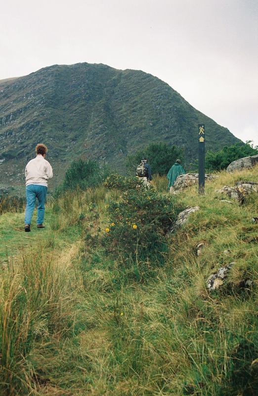
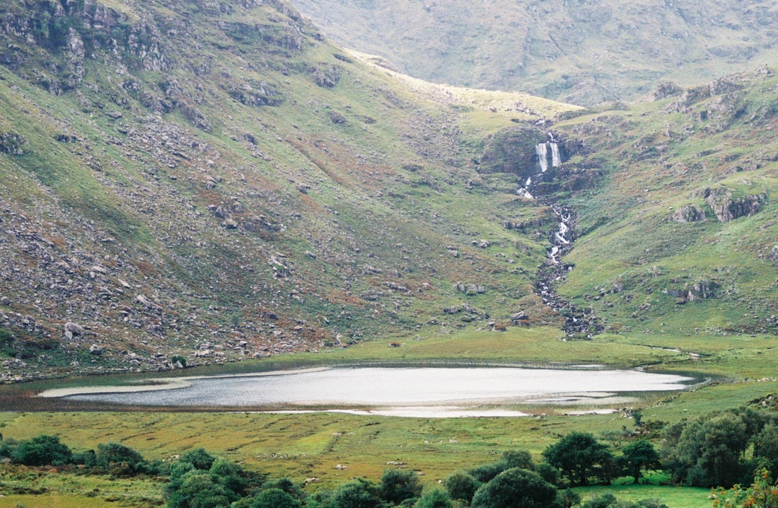
The rain started up again, and this time it was pouring. The trail, which was marked only about every quarter kilometer or so, continued to be difficult with rocks, boulders, marshy ground and the ever present sheep, which had no qualms about walking right up to us. (This was a little disconcerting, as some of these sheep were quite large and, with no prior experience with sheep, I didn’t know if they were going to bite or attack me. However, we had no trouble with them, for which I was thankful. ) At one point, we ended up at the base of a raging waterfall and were perplexed as to how we were to get across the fast-moving brook that the falls dumped into. Looking around, we noticed about 150 yards downstream a small footbridge crossing the brook, so we trudged along the streambed until we reached the bridge and were able to cross. A little farther on, we came to a unpenetrable fence and were puzzled how we were to get over it. Again, we looked around until we noticed a very tall wooden ladder placed over the fence. Once more, we started plodding our way toward the ladder when the rain suddenly felt like needles. It was sleeting! The sleet was coming down so fast and furious that we were unable to see much ahead of us. However, we made it over the fence and continued on our way, now freezing, shivering and drenched.
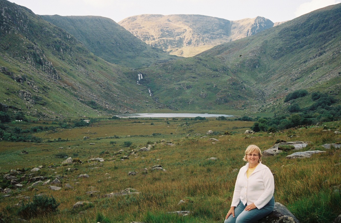
After awhile, the sleet/rain/drizzle stopped, and, while the sun didn’t actually come out, it did warm things up a bit and we started to dry out. We were getting near the end of the portion of the trail we were hiking, and the landscape abruptly changed. The rocks and marshy ground gave way to a low, steep mountain, which lay ahead. As I approached the mountain, my fellow hikers, who were already halfway up it, yelled down to me, “We’ll meet you at the top.” I started climbing the mountain certain that I was going to have a heart attack. Although it took me what seemed like forever and I felt like I blew out a lung, I finally arrived at the top of the mountain and met up with my little group. From the top, I could see in the not-too-far distance a farm, our rendezvous spot with Dennis.
It was to take about another hour before we met up with Dennis. We climbed down the other side of the mountain, slogged across pastures (this time containing cows, not sheep), ambled along a walled road, and walked through the farmer’s property, and then finally it was over. Susan, Betty and Rick beat me by about 20 minutes, but I had made it. My body was sore and I was wet and cold, but I had made it. And it took only about 6 hours, 3 hours longer than we thought it would! (To be fair, my fellow hikers would have done the trek much quicker if I hadn't been with them to slow them down.) Uncomplaining Dennis had to wait 3 hours for us.
The morning of our trek, we packed a hardy lunch and dressed in warm clothes. We knew it might rain (it always does in Ireland), so we also carried our ponchos. My husband, Dennis, dropped us off in the Black Valley, the area where we were going to pick up the trail. He was going to meet us 10 km up the road in 3 hours to pick us up.
The Black Valley in County Kerry is a remote location in the Macgillycuddy’s Reeks, a chain of mountains, many over 3,000 feet, which overshadow the Valley. The Black Valley is known as one of the most beautiful and unspoilt places in the world. The Valley has a wild, rugged and extreme beauty, yet also has calmness, friendliness and tranquility. It is a natural, untamed place that reflects the peoples' struggle to make a living throughout the ages. The valley is also noted for being the last place in Ireland to get electricity and telephone service because of its remoteness. In fact, some Kerry natives will joke about the Black Valley getting its name from remaining in the dark so long without electricity. It was not until 1976 that the Valley was finally connected.
Today, the Black Valley is still a remote and untouched part of Ireland. As the name 'valley' suggests, it is more of a dispersed area than a village with a center.
As Susan, Betty, Rick and I started “the hike,” we walked along a gravel road running next to beautiful, green pastures where black and white sheep grazed fenced in by stacked, stone walls. The road eventually turned into a wide grassy trail. Fluffy white sheep with red and blue markings foraged unrestrained along both sides of the path. Presently the trail became paved with large, flat rocks. Before long it started to drizzle, and we put on our ponchos. Soon we entered the Valley, and the trek turned difficult. Instead of a gently upward sloping path, the trail became a series of large boulders and wet, spongy ground. The sheep, which were everywhere and seemed totally oblivious of us, had no problems bouncing up and down the boulders, but I was having a time of it. It was slow going. My fellow trekkers soon were way ahead of me as I lagged behind, carefully climbing up and over boulders. Every 20 minutes or so, they stopped and waited for me to catch up.
The drizzle turned into a cold rain, and the wind started blowing hard, whipping our ponchos so that our clothes were soon sodden. Mercifully, we were all wearing hiking boots with thick socks, so our feet were warm and dry. We ate our lunch during a break in the rain, and then, feeling the call of nature, I found a large rock behind which to pee. I am known for my bathroom escapades while traveling (www.thebathroomdiaries.weebly.com), so of course Betty had to sneak (unbeknownst to me) and videotape me doing my business. Thankfully, no one else was around. (In fact, we saw only two other hikers [backpackers, actually] the entire time we were on the trail, and that was at the very beginning of our hike.)
The rain started up again, and this time it was pouring. The trail, which was marked only about every quarter kilometer or so, continued to be difficult with rocks, boulders, marshy ground and the ever present sheep, which had no qualms about walking right up to us. (This was a little disconcerting, as some of these sheep were quite large and, with no prior experience with sheep, I didn’t know if they were going to bite or attack me. However, we had no trouble with them, for which I was thankful. ) At one point, we ended up at the base of a raging waterfall and were perplexed as to how we were to get across the fast-moving brook that the falls dumped into. Looking around, we noticed about 150 yards downstream a small footbridge crossing the brook, so we trudged along the streambed until we reached the bridge and were able to cross. A little farther on, we came to a unpenetrable fence and were puzzled how we were to get over it. Again, we looked around until we noticed a very tall wooden ladder placed over the fence. Once more, we started plodding our way toward the ladder when the rain suddenly felt like needles. It was sleeting! The sleet was coming down so fast and furious that we were unable to see much ahead of us. However, we made it over the fence and continued on our way, now freezing, shivering and drenched.
After awhile, the sleet/rain/drizzle stopped, and, while the sun didn’t actually come out, it did warm things up a bit and we started to dry out. We were getting near the end of the portion of the trail we were hiking, and the landscape abruptly changed. The rocks and marshy ground gave way to a low, steep mountain, which lay ahead. As I approached the mountain, my fellow hikers, who were already halfway up it, yelled down to me, “We’ll meet you at the top.” I started climbing the mountain certain that I was going to have a heart attack. Although it took me what seemed like forever and I felt like I blew out a lung, I finally arrived at the top of the mountain and met up with my little group. From the top, I could see in the not-too-far distance a farm, our rendezvous spot with Dennis.
It was to take about another hour before we met up with Dennis. We climbed down the other side of the mountain, slogged across pastures (this time containing cows, not sheep), ambled along a walled road, and walked through the farmer’s property, and then finally it was over. Susan, Betty and Rick beat me by about 20 minutes, but I had made it. My body was sore and I was wet and cold, but I had made it. And it took only about 6 hours, 3 hours longer than we thought it would! (To be fair, my fellow hikers would have done the trek much quicker if I hadn't been with them to slow them down.) Uncomplaining Dennis had to wait 3 hours for us.


In and Around Killarney

Killarney is in County Kerry in southwestern Ireland. Cill Airne in Gaelic means the Church of the Sloes.
In 2005, Killarney celebrated the 250th Anniversary of the birth of the town of Killarney. The 250 year story began with Thomas Fourth Viscount Kenmare who came of age in 1747. He had the vision to attract visitors to Killarney. He developed the town as it is known today. Writing in 1756, Charles Smith said, "The town of Killarney is a small thriving place, being considerably improved, since the minority of the present owner, the Lord Viscount Kenmare, who hath encouraged several inhabitants to settle in it, and hath erected some houses for linen manufacturers about a mile from the town. There are already four great new roads finished to this town. The neighborhood of the mines offers employment of several people and will, consequently, cause a considerable sum of money to be spent in it."
Richard Pococke visited Killarney in 1749 and returned in 1758. Writing from Killarney on August 31, 1758, he said, "It is wonderful to see what Lord Kenmare has done in about nine years. He has made a walk around the Isle of Innisfallen . . . and built a house there for company to dine in. He has built a tower and steeple in the church, market house, caused many roads to be made and some at his own expense, allotting the profits of a salmon fishery to public works; he has encouraged tenants to build three or four streets by giving them long leases; he has a variety of boats to attend all strangers; and what is more extraordinary, he has raised such a town without any manufacture."
Mountain, lake and luxuriant woodland are the hallmarks of Killarney. Since the 1750s, visitors have been attracted by the physical beauty of the place, by its rich natural history, its unique store of legend, the evidence of human habitation going back up to 9,000 years.
The adventurous sons of wealthy English houses were the backbone of the 18th and early 19th century tourist industry in Killarney.
The building of the three major access roads in the 1820s ... Bianconi horse drawn coaches ... the visits and writings of romantic poets like Tennyson, Wordsworth, Scott, Austin had a huge impact. The opening of the railway in 1853 was the beginning of the modern tourist trade. To keep pace, more hotels were built. The Muckross Hotel opened in 1790 and the Great Southern celebrated 150 years in 2004.
By 1870, some 40 people worked for five Arbutus and bog oak manufacturers. Here the products ranged from snuff boxes to a writing desk and a table presented to Queen Victoria on her visit to Killarney in 1861.
The Killarney guide was a special feature of a Killarney holiday. Not only did he know how to see all of the area, he also had a smattering of knowledge of the area's natural history, its historic remains but most especially was a superb story teller. The inheritors of that legacy are the boatmen, ponymen and jarveys (who drive the horse-drawn jaunting cars).
The huge publicity of Queen Victoria's visit in 1861 launched Killarney internationally as a place to visit. The first half of the 20th century was difficult because of national and international disturbances. There were major surges in the Killarney tourist industry in the 1960s—because of government grants—and the 1990s stimulated by tax incentives and a buoyant economy. Today Killarney Town and its surrounding urban area is County Kerry’s second largest town and has a population of almost 13,500 (Census 2006).
Like most Irish towns, Killarney has no shortage of pubs. This small town boasts 50 of them, and pub culture is a part of the local people's everyday life. The ones we went to were crowded, rowdy and had live Irish music, even bagpipers. Personally, I didn’t do too much drinking, but my fellow travelers drank enough Guinness to last a lifetime!
